| For other uses, see Map (disambiguation) |
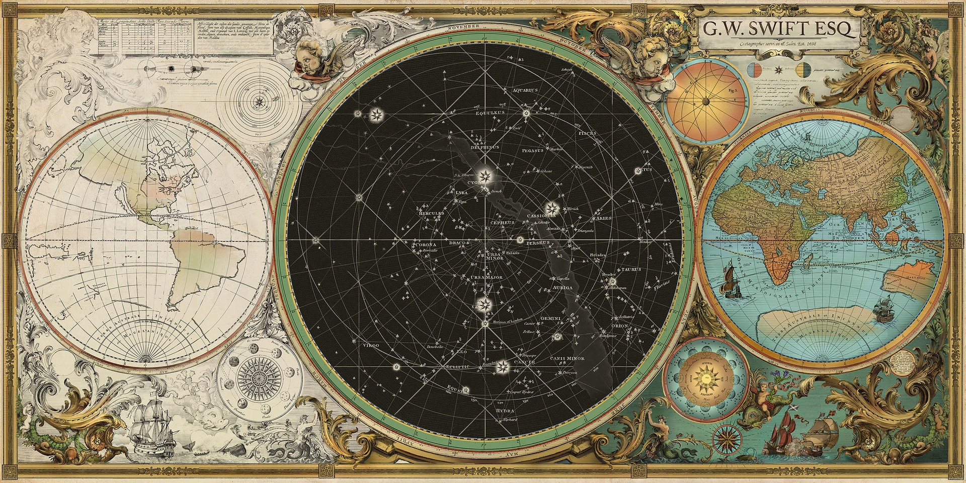
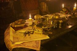
The maps of the world, the sea, the sky and stars as seen in the Swift and Sons Chart House in Saint Martin.
- "Jack Sparrow is a dying breed. The world is shrinking, the blank edges of the map filled in. Jack must find his place in the New World or perish."
- ―Cutler Beckett
A map was a visual representation of an area or territory, whether real or imaginary; a diagram of components of an item. Maps were used to search for various treasures as well as certain places.
History[]
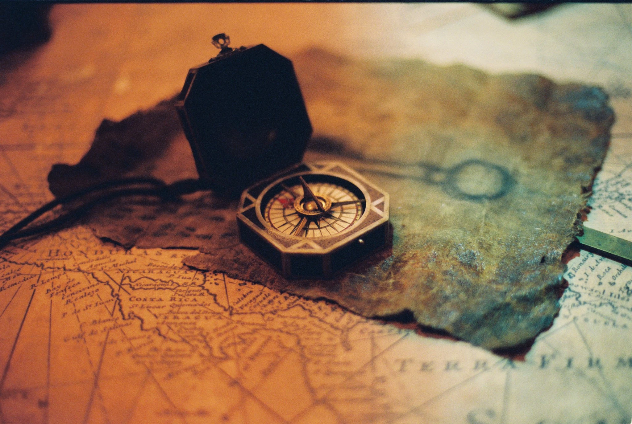
Captain Jack Sparrow's compass and a drawing of a key sitting on at least a map of South America aboard the Black Pearl.
- "Master Gibbs, short we are a map. Perhaps you'd be so kind as to provide us an heading."
- ―Hector Barbossa to Joshamee Gibbs
There were many types of maps throughout history, including naval charts and treasure maps, used by Royal Navy officers and pirates, among other sailors and adventurers. The day after Elizabeth Swann was kidnapped from Port Royal by Captain Hector Barbossa's cursed crew, Commodore James Norrington of the British Royal Navy studied the map of the Lesser Antilles, trying to establish the most likely course the pirates took. Not satisfied with Norrington's plan of action, young blacksmith Will Turner slammed his axe into the commodore's desk, through the map, cutting the island of Guadeloupe in half.[1]
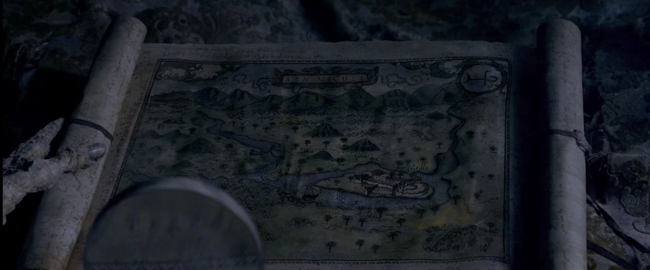
Ponce de León's map of San Miguel.
Some maps showed the entire world, like the world map in Lord Cutler Beckett's office.[2] Sao Feng's navigational charts, known as the Mao Kun Map, was used to lead its reader to locate some of the world's more obscure, mystical, and supernatural places; the dates and distances could change and mislead the traveler who uses the map unwisely.[3] Sao Feng's map would be used by Hector Barbossa to find Davy Jones' Locker in the desperate quest to save Jack Sparrow, who later used a separate map within the charts at the beginning of the quest for the fabled Fountain of Youth.[4] Barbossa and Sparrow later found Ponce de León, now a skeletal figure lying in his bed aboard the stranded Santiago, peering at a map of San Miguel with a magnifying glass.[5]


The British map of the area west of the Windward Isles in the Lesser Antilles.
When the British warship, the Monarch, chased the pirate ship, the Ruddy Rose, into the waters west of the Windward Isles in the Lesser Antilles, which the young sailor Henry Turner identified as the Devil's Triangle, the Monarch's commanding officer Captain Toms checked his navigational charts, discovering that the area was into named simply "Uncharted waters" prior to an attack by an army of the dead led by Armando Salazar. Later, during Hector Barbossa's search for the Trident of Poseidon, the young astronomer Carina Smyth warned the weathered sea captain of the Black Pearl that his map was incomplete. Eventually, realizing the map was indeed in the stars, Barbossa allowed Carina to steer the Pearl. Following Barbossa's second death, Jack Sparrow reclaimed his captaincy of the Black Pearl, where Joshamee Gibbs took some navigational charts, asking Sparrow what would be their next heading. When Sparrow simply replied that they would follow the stars, Gibbs enthusiastically threw the charts behind.[6]
Behind the scenes[]
The seafaring charts in Blackbeard's cabin.
- "So I went back to an earlier idea that I had about a circular map with rings that represented metaphorical places to which you could travel, which I thought tied into the whole 'Pirates' theme. Gore and I had been talking about the notion that 'Pirates of the Caribbean' takes place during a time in history in which the maps weren't yet filled in, which means that anything is possible in the world. There are all these places in the world that are Terra Incognita-lands that are unknown-so they could have monsters, they could have magic, they could have new civilizations. I loved the idea that this map was very old, made before the Enlightenment, before people got so scientific about mapmaking, when they still blurred the geographical realities with metaphorical inner journeys which are as important as physical journeys."
- ―James Byrkit
- Maps first appeared in Walt Disney's Pirates of the Caribbean, specifically in the "Captain's Quarters" tableaux where guests see a skeletal pirate in bed, peering at a map with a magnifying glass, surrounded by his treasure.[7]
- In Pirates of the Caribbean: The Curse of the Black Pearl, during the battle of Isla de Muerta, Hector Barbossa tells Jack Sparrow "You're off the edge of the map, mate. Here there be monsters!"[1] It derives from the inscriptions on old maps of the mostly unexplored world, were on the edges, the mapmaker, having run out of information, would draw fanciful creatures (such as Sea Serpents) and write, Here There Be Monsters.[8][9] This is most likely a reference to the real-world phrase "Here be dragons" which medieval cartographers put on the maps along the illustrations of dragons, sea monsters and other mythological creatures to indicate potential dangers in uncharted areas.[10]
- In Ted Elliott and Terry Rossio's first screenplay draft for The Curse of the Black Pearl, when Barbossa talked with Elizabeth Swann about the curse of the Aztec Gold, he opened his Captain's chest which contained a Mayan codex, gold, a sextant, and some charts.[11]
- In Terry Rossio's screenplay draft for Dead Men Tell No Tales, Philip Swift lost contact with Syrena and became a cartographer so he could make a map that would lead to the treasure of all treasures, the legendary Mermaid Trove. The map eventually ended up in Jack Sparrow's possession who successfully found the Trove.[8][9]
- In the non-canonical LEGO Pirates of the Caribbean: The Video Game, Ponce de León's logbook was stolen from the Spanish by Angelica, but not before King Ferdinand took from it the map with the route to the Fountain of Youth.
Appearances[]
- Walt Disney's Pirates of the Caribbean (First appearance)
- Climb Aboard if you Dare!: Stories from the Pirates of the Caribbean
- Jack Sparrow: The Coming Storm
- Jack Sparrow: Silver
- Jack Sparrow: The Timekeeper (Mentioned only)
- Pirates of the Caribbean: Six Sea Shanties
- The Price of Freedom
- Legends of the Brethren Court: The Caribbean
- Legends of the Brethren Court: Rising in the East
- Legends of the Brethren Court: The Turning Tide
- Legends of the Brethren Court: Wild Waters
- Legends of the Brethren Court: Day of the Shadow
- The Compass of Destiny!
- Pirates of the Caribbean: The Curse of the Black Pearl (video game)
- Pirates of the Caribbean: The Missing Pirate
- Pirates of the Caribbean: The Curse of the Black Pearl
- Pirates of the Caribbean: The Legend of Jack Sparrow
- Mother of Water
- The Capture of Jack Sparrow!
- The Compass of Destiny!
- The Dark Skull
- The Lost Sea
- Pirates of the Caribbean Online
- Pirates of the Caribbean: Dead Man's Chest
- Pirates of the Caribbean: At World's End
- Pirates of the Caribbean: On Stranger Tides
- The Brightest Star in the North: The Adventures of Carina Smyth
- Pirates of the Caribbean: Dead Men Tell No Tales
- LEGO Pirates of the Caribbean: The Video Game (Non-canonical appearance)
- Sea of Thieves: A Pirate's Life (Non-canonical appearance)
Sources[]
External links[]
 Map on Wikipedia
- Nautical chart on Wikipedia
Notes and references[]
- ↑ 1.0 1.1 Pirates of the Caribbean: The Curse of the Black Pearl
- ↑ Pirates of the Caribbean: Dead Man's Chest
- ↑ Pirates of the Caribbean: On Stranger Tides: The Visual Guide, pp. 26-27: "Mao Kun Map"
- ↑ Pirates of the Caribbean: At World's End
- ↑ Pirates of the Caribbean: On Stranger Tides
- ↑ Pirates of the Caribbean: Dead Men Tell No Tales
- ↑ The Art of Pirates of the Caribbean: On Stranger Tides
- ↑ 8.0 8.1 Wordplayer.com: PIRATES OF THE CARIBBEAN: DEAD MEN TELL NO TALES by Terry Rossio
- ↑ 9.0 9.1 Pirates of the Caribbean - Dead Men Tell No Tales - Annotations - Terry Rossio - 8/14/12 - Page 24
- ↑ Here be dragons - Wikipedia
- ↑ Wordplayer.com: PIRATES OF THE CARIBBEAN: THE CURSE OF THE BLACK PEARL by Ted Elliott & Terry Rossio